Plan the route on your computer with the web app: it snaps to real OpenStreetMap tracks and generates the roadbook (a box for every junction with its tulip, distances, dangers and landmarks). Print it on a roll or follow it on the bike with the Android app RM Roadbook.
Maps available: Spain. Need another country? Write to us and we'll add it. The app interface is in Spanish for now.
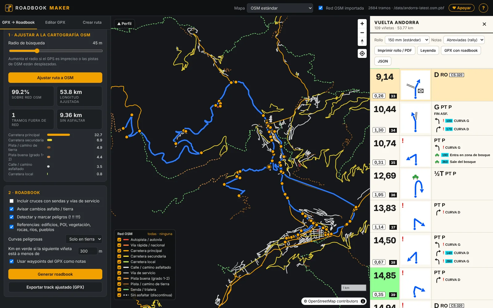
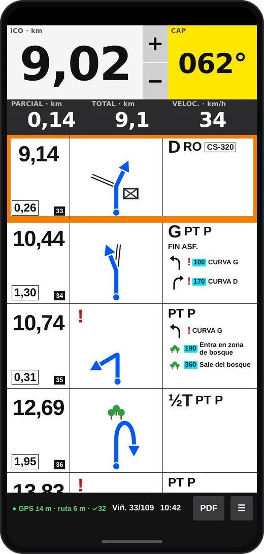
Roadbook Maker has two parts, used at different moments. Routes and roadbooks are only created in the web app; the Android app doesn't create routes: it opens the roadbook you made on the web.
To create and prepare: load a GPX or draw the route on the map, snap it to the tracks, edit it and generate the roadbook.
To navigate: shows the roadbook box by box with trip meter (ICO), CAP and Bluetooth remote, and its assist mode warns you if you go off route.
A roadbook is the route sheet used in rallies: a column of boxes read from top to bottom, each with its distance and a tulip (a diagram of the junction). Making one by hand takes hours; Roadbook Maker does it from a GPX or from a route you draw on the map.
The track is matched to the OpenStreetMap network: it knows what is a dirt track, a trail or a road, where the junctions are and which sections go cross-country.
A box for every junction with the route in blue, total and partial distance, green distance when the next box is close, dangers ! !! !!! and landmarks.
Print the 150 mm roll for your roadbook holder or carry it on your phone with RM Roadbook, with trip meter and Bluetooth remote.
From a route's GPX to the printed roll or the phone on your handlebars.
Open a GPX (yours, a friend's or from a route website) or draw the route by clicking on the map: it is routed along dirt tracks, back roads or motorways depending on the profile you choose.
The route snaps to OpenStreetMap tracks. If something doesn't fit, the editor moves points, cuts, joins or extends the route along the tracks. 80 Check the elevation profile.
One click and you have the boxes: print them on a roll (150 mm PDF), download the “GPX with roadbook” (one waypoint per box) or open it on your phone with RM Roadbook.
The web app has three tabs: GPX → Roadbook, Editor GPX (GPX editor) and Crear ruta (create route). All of them show the elevation profile and the map with the imported track network.
Load the GPX, match it to OSM and generate the roadbook. Click on a box and the map centres on that junction.
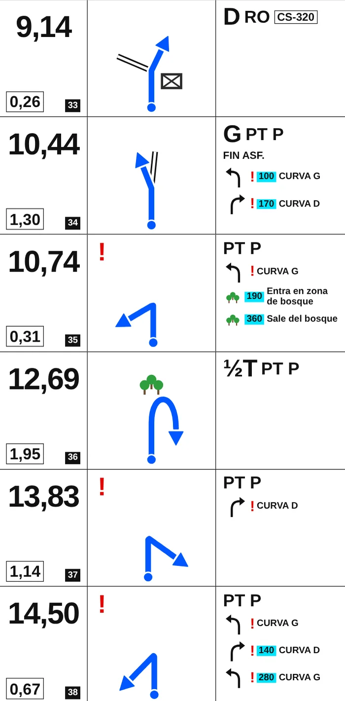
Three columns read downwards, like competition roadbooks (FIA/FIM conventions), in the standard width of roadbook holders (150 mm, or 148, 140, 120 and 100).
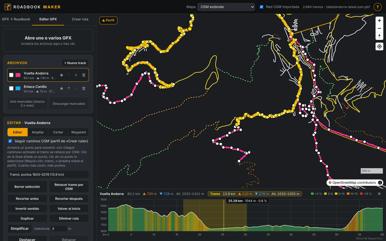
Like gpx.studio, but on your maps and designed for the roadbook.
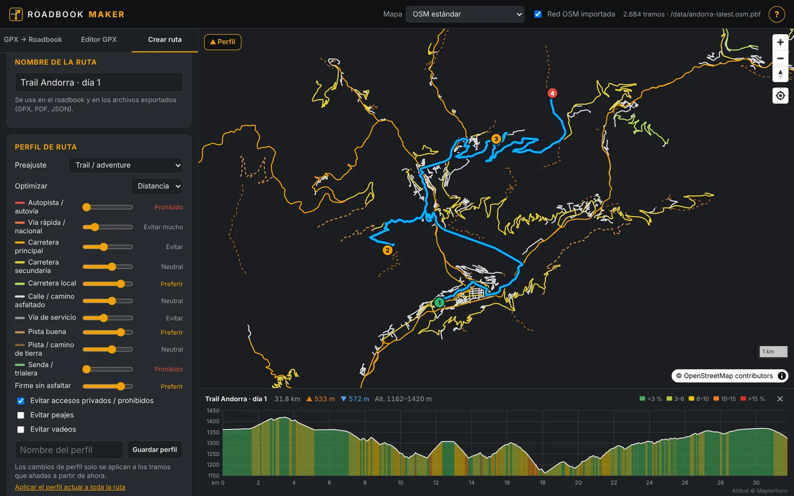
The route is calculated on the OSM network with a profile tailored to you.
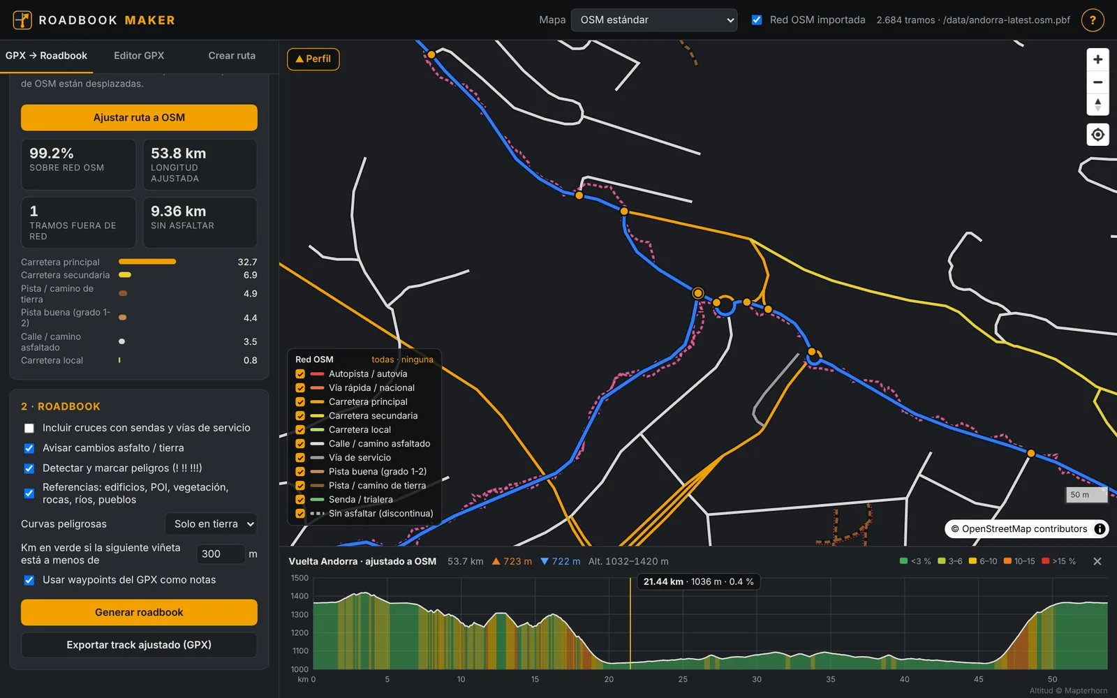
The “⛰ Perfil” (profile) button shows the route's elevation in any tab: total ascent and descent, gradients by colour and, on hover, the point on the map. Drag over the profile to see the figures for a section.
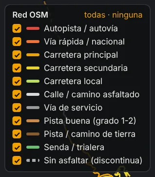
Base maps: OSM, topographic, CyclOSM, satellite, hybrid and PNOA (Spanish aerial imagery). Turn each type of way on or off in the legend.
RM Roadbook doesn't create routes: it is the on-bike reader for the roadbook you prepare in the web app. It opens the roll PDF on your phone or tablet and shows it box by box, with the data of a rally trip master and an assist mode that warns you if you go off route. It works in portrait and landscape, and with a Bluetooth remote on the handlebars.
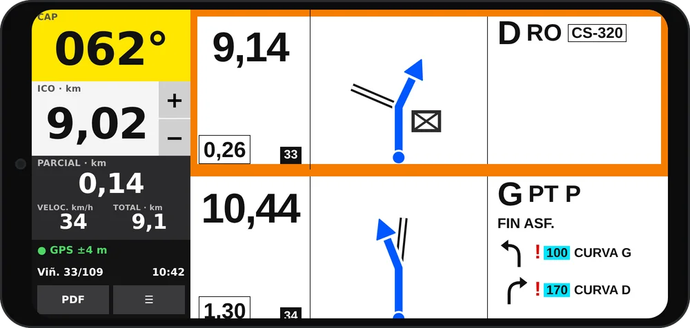
Large trip meter (ICO) to compare with each box's distance, with − / + buttons beside it to correct it instantly (double tap to set a value), one-tap partial reset, total, speed and the real CAP from the GPS. The screen stays on and the GPS keeps counting in the background.
Tap to go to the next box and double tap to go back. Assign your remote's buttons (short and long press) to next or previous, correcting the trip meter, resetting the partial…
From the ☰ menu or the remote: record your ride (also with the screen off), pause and resume, and save it to Downloads or share it. It warns you if your phone is running out of space or the GPS doesn't have a good signal yet. It's the GPX you submit to the navigation events.
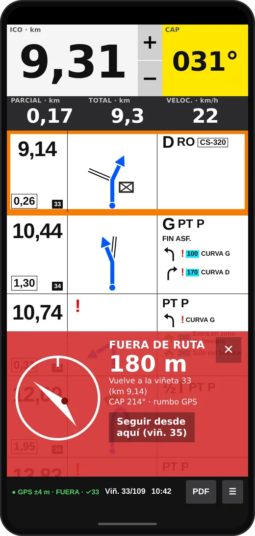
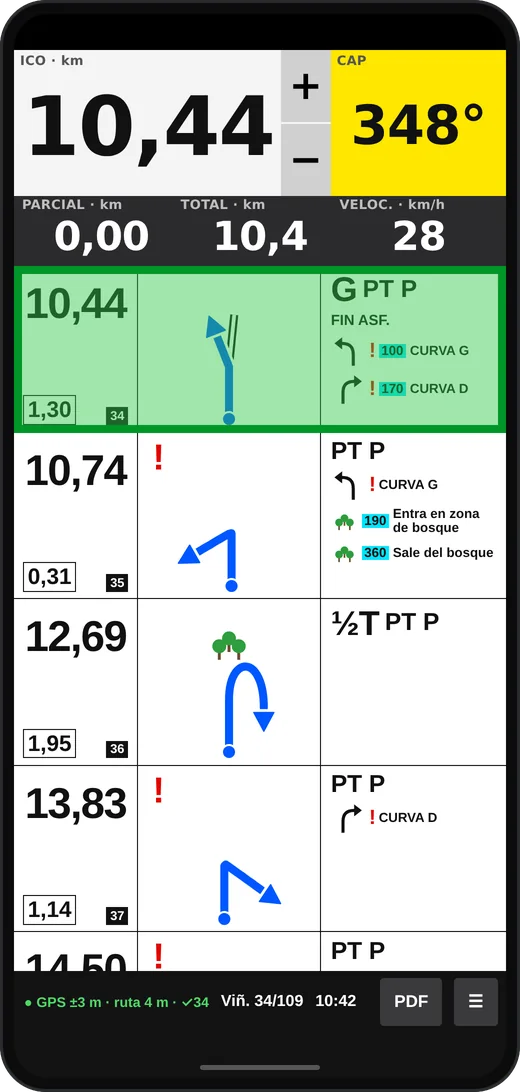
Load into RM Roadbook the “GPX with roadbook” exported by Roadbook Maker (it has one waypoint per box) and the app follows your progress along the track while you read the roll.
The arrow uses the GPS heading while moving and the phone's compass when stopped. Warnings don't block the roadbook and are dismissed with ✕ or a remote button. The app interface is in Spanish.
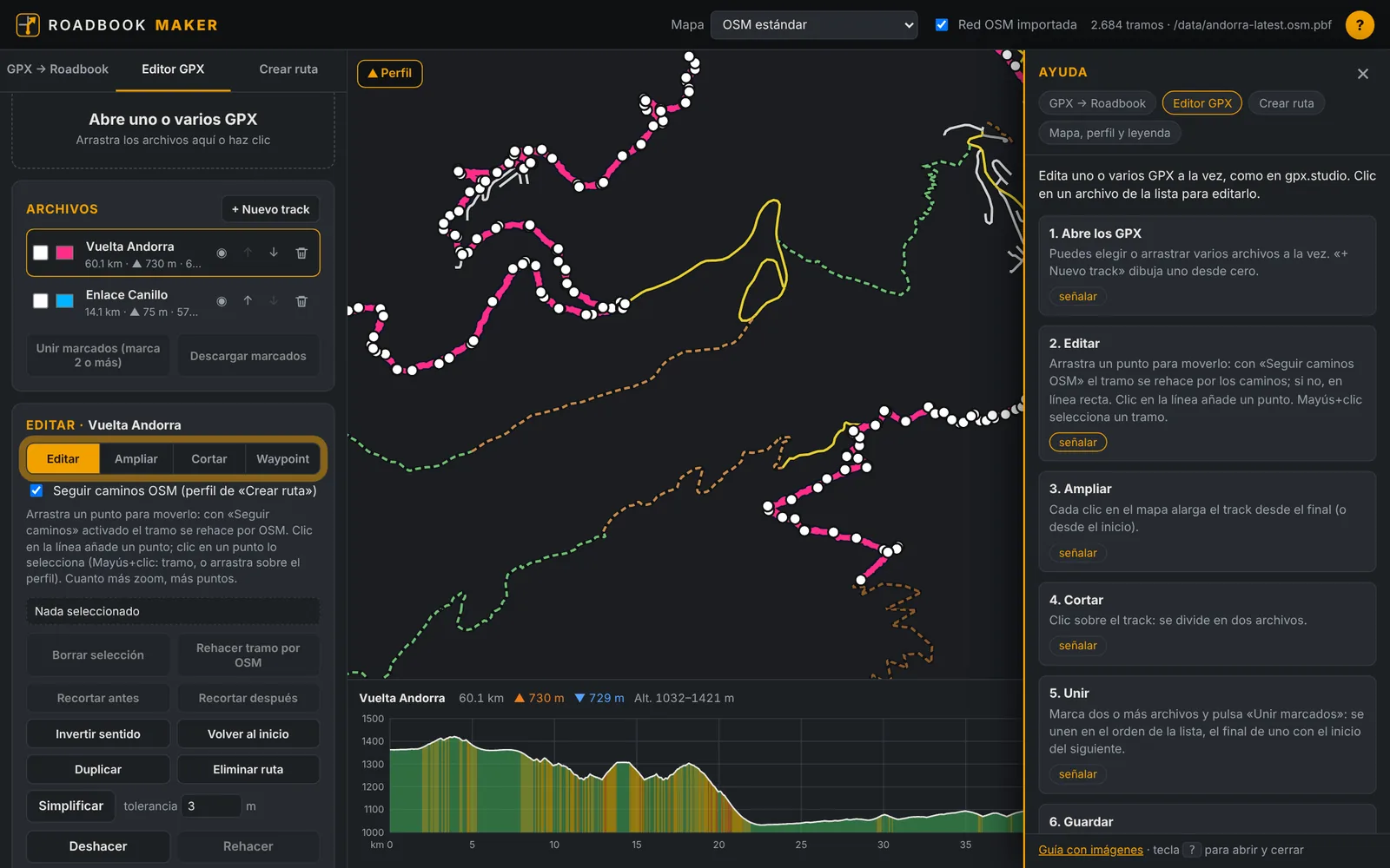
Inside the app, the “?” button at the top right (or the ? key) opens the help: a panel with the steps for the tab you are on, tips and keyboard shortcuts (in Spanish).
We publish events that stay open for several days: you download the roadbook as a PDF, ride whenever you like with RM Roadbook recording your track, and submit it with your nickname. The fastest rider doesn't win, whoever follows the route best does: your track is compared with the official one, which nobody sees, and the standings are public. Off-road and on-road events.
Our channel has step-by-step tutorials (GPX to roadbook, GPX editor, creating routes, printing the roll and the Android app's assist mode) and videos of our rides. The videos are in Spanish.
Open the app and load a GPX, or draw the route on the map.
Questions, ideas, bugs or want to collaborate? Need the maps of another country (currently Spain)? Write to us, in English or Spanish:
[email protected] ROADBOOK MAKER