 ROADBOOK MAKER
From GPX to rally roadbook in a minute
Load any GPX and Roadbook Maker turns it into a rally roadbook: a box for every junction with its tulip, distances, dangers and landmarks, matched to real OpenStreetMap tracks. Free, in your browser.
Convert my GPX now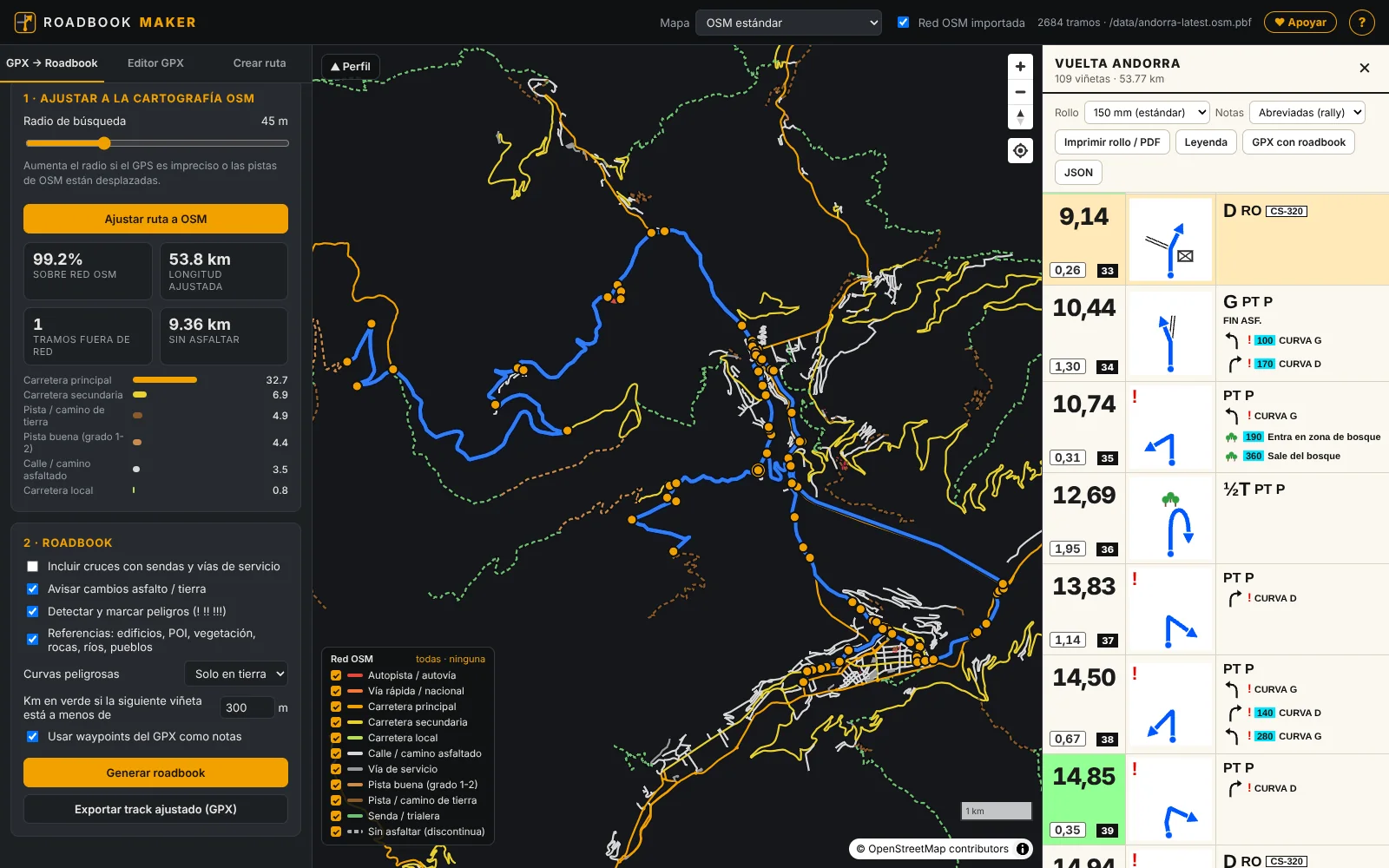
How to convert a GPX into a roadbook
- Load the GPX in the “GPX → Roadbook” tab. It can be yours, a friend's or one from a route website.
- Snap it to the tracks. The track snaps to the OpenStreetMap network: the original in pink, the matched one in blue and, in red, sections with no track.
- Choose the options: dangers, tight bends on dirt, landmarks and green distances when the next box is close.
- Generate and export. Download the roll as a PDF (150 mm, or 148, 140, 120 and 100 mm) or the “GPX with roadbook”, with one waypoint per box.
What each box contains
Three columns read from top to bottom, like competition roadbooks: total and partial distance, the tulip with the route in blue, and the notes with dangers (! !! !!!), obstacles and landmarks. Where the route goes cross-country, the CAP (heading) appears in a yellow box. If it's your first time, read how to read a roadbook.
What if the GPX doesn't follow the tracks well?
Run it through the GPX editor in the same app first: move points and the section is rebuilt along the tracks; cut, join several routes, reverse or simplify. Then send it straight to the roadbook.
From your computer to the bike
Print the roll for your roadbook holder or open the PDF on your phone with RM Roadbook, the Android app with trip meter (ICO), GPS CAP, Bluetooth remote and an off-route warning.
Frequently asked questions
Does any GPX work? Yes. For now the maps cover Spain; if you need another country, write to us.
How much does it cost? Nothing. If you find it useful, you can support us on Patreon.
And cross-country sections? They are drawn with a dashed line and the CAP in yellow, so you know the heading.
Open Roadbook Maker